Pella Excavations (1967-2023)
Introduction
There have been 38 discrete excavation areas declared at Pella since major excavations began in 1967. Wooster College commenced excavations in March 1967 for a single season, and declared two areas the West Church complex (Area I) and the Eastern Cemetery (Area II).
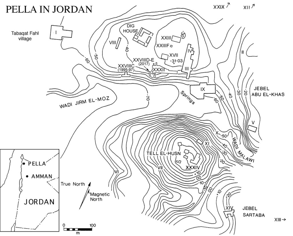
When excavations recommenced in 1979 as a joint Sydney-Wooster expedition, many new areas were opened over the first six years. Some were placed over individual structural features in the hinterland landscape (walls, forts, mosques), or for dense artefact scatters that had no structural associations (Palaeolithic/Neolithic encampments), or for cemetery areas (all periods) that ring the central site out to a distance of five kilometres. As well as these ‘single purpose’ excavation areas, others were designated as long-term foci of intense investigation, all on or near the main tell of Khirbet Fahl.
The late 70s and the early 80s at Pella
Wooster College continued limited work in the West Church (Area I) in 1979-80. Main work focussed on the “West Cut’ (Area VIII), an area excavation (25 x 5m) through the western tell stratigraphy of Khirbet Fahl, and what proved to be their largest excavation area, the Civic Complex (Area IX) at the head of the Wadi Jirm, which saw the excavation of the Cathedral church, the Odeon and what may be part of a Bath-house. Both Areas VIII and IX were worked between 1979-1985. Thereafter, Wooster ceased fieldwork at Pella.
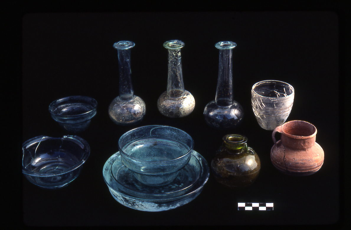
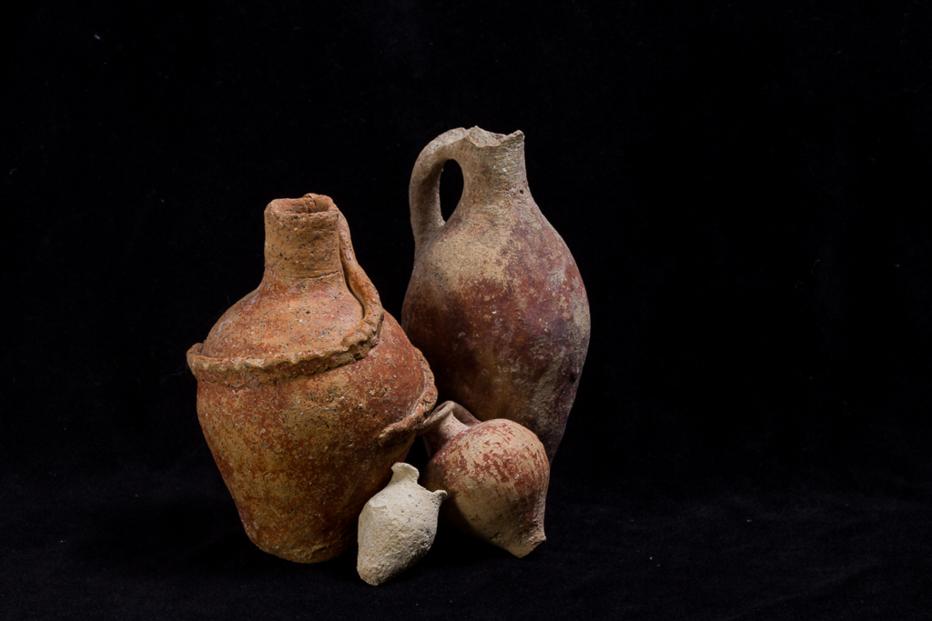
Sydney teams initially focussed on the eastern tell of Khirbet Fahl, instituting a 30 x10m ‘East Cut’ (Area III) through all layers on the southeast corner of the tell, while opening a large area excavation (30 x 90m) immediately to the north (Area IV), exposing considerable areas of the eastern regions of the Late Byzantine/Umayyad city. These twin foci took up much effort throughout the 1980s and into the early 1990s. As well, between 1979-85 Australians investigated the ‘East Church’ (Area V), located high on the slopes of Jebel Abu al-Khas. Finally, two main cemetery areas were excavated by Sydney and Wooster teams – the Husn South Cemetery (Area VII) and the Husn North Face cemetery (Area XI). The first produced Imperial Roman burials, and the second Middle Bronze Age graves, together providing many of the more spectacular finds made during the early seasons of work at Pella.
The late 80s through the 2000s
After Wooster ceased fieldwork, and Sydney completed work in Areas III-IV, work in the late 1980s expanded to include significant off-tell investigations. This featured Intensified work five kilometres north of Pella on the Wadi Hammeh Natufian site (Area XX), on an Islamic Abbasid-period caravanserai (Area XXIX) immediately north of the main mound, and on the Tell Husn summit with the Byzantine fortress excavations (Area XXXIV). These areas of work dominated efforts in the later 1980s and early 1990s.
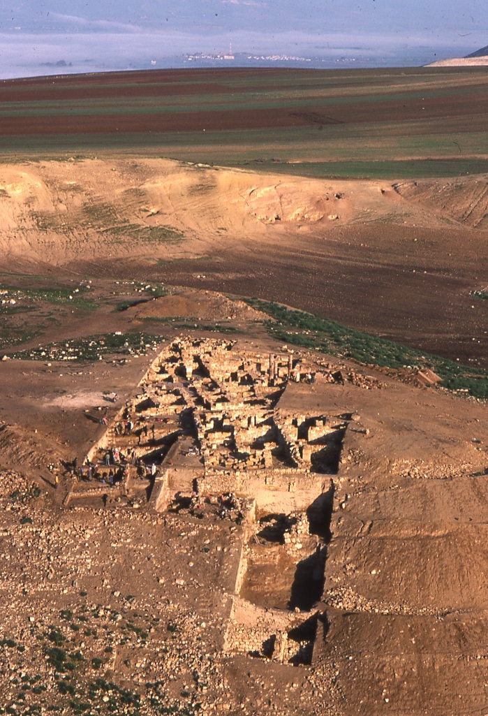
From the 1990s, a concerted effort was made to plumb the very earliest (Neolithic through Early Bronze Age) horizons along the south side of the main mound (Area XXXII). These efforts began in 1992 with small probes but gradually expanded into 17 x 5m area excavations. Over the course of the 1990s and into the early 2000s, various deep probes were carried through nearly 10m and 4000 years of occupational strata (6500-2500 BCE) into sterile layers at the base of the tell. Of necessity the areas of these investigations were often constrained by the great depth of prehistoric deposits below later materials, and (rather more unexpectedly) by the discovery of a monumental Middle Bronze Age (MBA) stone temple, which occupied much of the area then available for excavation.
Research into the early horizons in Area XXXII continues, although now largely focussed on exposing the extensive sequence of Middle and Late Bronze Age Palatial structures west of the monumental MBA temple. As well, ongoing from 2011, work on aspects of the latest occupational horizons (Hellenistic through Late Islamic) on the central tell region (Area XXIII) have been expanded south of the original central mound exposures (Area XXIIIA) to check earlier results and increase the overall horizontal exposures in these horizons. Finally, as the hoped-for large areas of prehistoric exposures on the main mound (especially pertaining to the first city of the Early Bronze Age) were denied, we returned to the east summit of Tell Husn (Area XXXIV) in 1994, where an extensive Early Bronze Age exposure was noted below the Byzantine fortress excavations. Work here is also ongoing, and has to date exposed seven distinct horizons of Chalcolithic and Bronze Age occupation that lay below the Byzantine fortress.
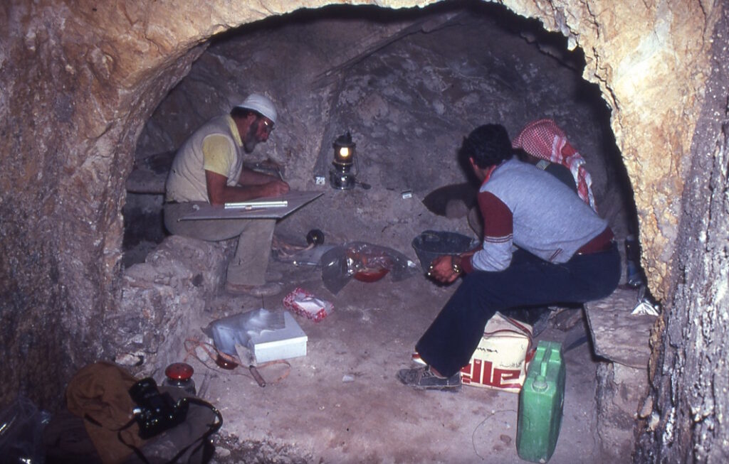
Area XXXVIII (by Kate da Costa)
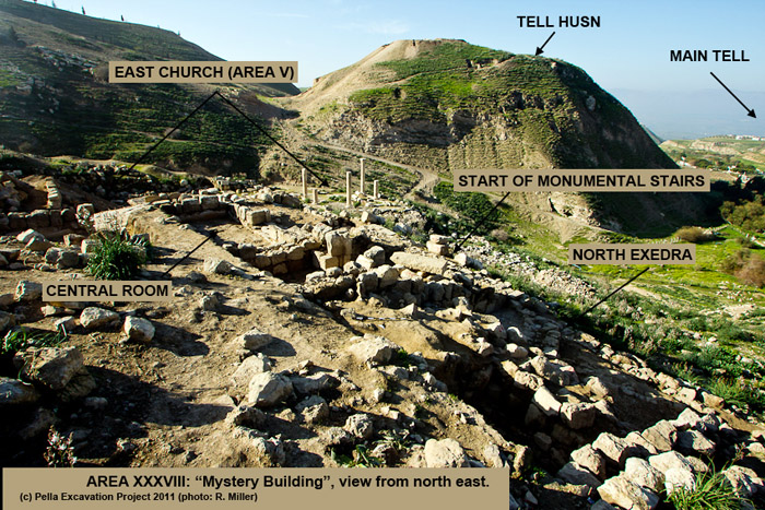
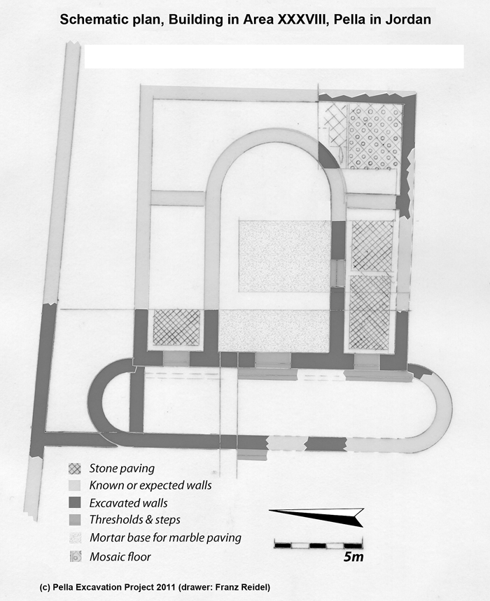
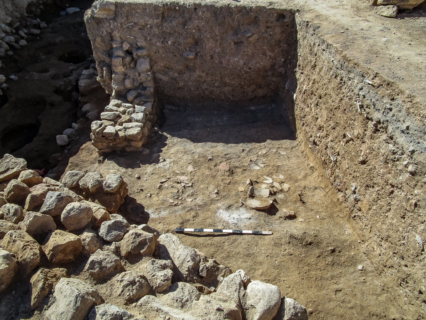
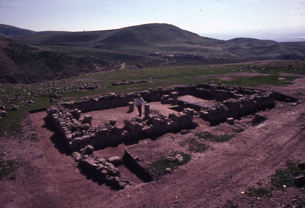
Area XXXVIII was opened in 2011 to explore the building to the north of the East Church, which had been excavated by the University of Sydney as Area V in the initial seasons of work (1979-1982). Surface wall lines showed that the XXXVIII building, like the East Church, was reached by a monumental staircase. This terminated in a flattish, square area. Two columns could be seen, similar to the columns in the atrium of the East Church – which were thought to have been reused from an earlier building. Anthony McNicoll, in 1979, had speculated that in this area of the site there had been a Roman period temple, which, when ruined, had been quarried for the stones to build the East Church. We were fairly confident then, since Tony had excavated a church, that we would have the temple. Luckily, I told people I was 99% confident, because from the first week of excavations it was clear that our new building had been erected at the same time as the East Church – somewhere in the 5th century AD – and there was no Roman temple beneath it.
We excavated about one third of the building. Its exact function remains unclear, but it appears to be ecclesiastical in nature – though not certainly a church. There is a narrow terrace, with exedrae at the north and south ends (or, if it is a church/chapel, an apsidal narthex). A central apsidal room, with marble flooring, is flanked by passages to north and south. The south passage opens to a corner room/space which in turn leads to a small passage running behind the apse, but within the building, making what appears to be an ambulatory. The building was lavishly decorated with glass wall mosaic, much of it gilded.
At some point, the building fell out of use, possibly damaged in an earthquake or robbed out. Its final use was domestic in nature – we found kitchen equipment and a hearth outside the northern door, on the robbed floor of the terrace/narthex. In the south-east corner was a typical assemblage of the Umayyad period, mirroring the material found in Area III/IV. We can therefore date the final destruction of the building to the massive 749 AD earthquake.
Current Excavation Areas
The current and planned (2023) excavations in the three areas (Area XXIII in the Central Tell, Area XXXII on the Southern Tell, and Area XXXIV on Tell Husn East Summit) will be outlined in further detail below.
Area XXIII (Central Tell) Hellenistic through Mameluke (c. 150 BCE-1500 CE)
In 1958, two American scholars spent 10 days at Pella, and opened two 5 x 7m soundings to investigate the sequence. One of these was placed in the central tell region, and penetrated through the Classical/Late Antique occupation horizons deep into the Iron Age, before excavations halted.
In 1983, 14 x 10m Trench XXIIIA was opened around the early American sounding, to check the stratigraphy first explored in 1958. The presence of Late Islamic Mameluke (c.13th-15th CE) and Middle Islamic Abbasid (c. 8th-10th CE) horizons attracted attention, as these had been scarce in excavations to that time. In 1988 two additional 10 x 5m trenches (XXIIID and XXIIIE) were opened either side of Trench XXIIIA to further investigate these Later Islamic horizons. The Mameluke period remains proved to be largely dump deposits, while the Abbasid remains were fitful architecturally and largely confined to deep well-like pits.
The presence of unexpectedly high-status Hellenistic remains (polychrome wall paintings, bronze statuary fragments) from the limited early work in Trench XXIIIA prompted renewed work in 10 x 5m Trench XXIIID in 2011. Parts of a large Middle Hellenistic (c. 150-80 BCE) townhouse were revealed over the next four field seasons (2011-2017), as excavations gradually expanded further to the south and east. Mudbrick walls with plastered benches and storage niches, complete (if shattered) Rhodian amphorae, bronze arrowheads, marble statuary fragments and much high-status red-slipped and grey-impressed pottery, was recovered from the fiery destruction horizon that brought the Hellenistic period occupation to an end. Very probably this occurred at the hands of the Hasmonaean ruler Alexander Jannaeus, who is known to have destroyed Pella around 80 BCE.
As the Hellenistic period excavations spread south from the original Area XXIII exposures, more and more coherent Mameluke period architecture appeared. This prompted a second initiative, what grew over two seasons (2017-19) into a new 4 x 15m Trench XXIIIF, located some 10m south of Trench XXIIID, to investigate the latest Islamic architecture on the site. This started out by sounding several buildings in what quickly emerged as a large very probably governmental civic/military compound, hitherto unsuspected and located perhaps 15m north of the splendid Mameluke period (ca. 1300 CE) mosque (Area XVII), excavated in 1982. We now see the mosque and the compound are likely to be parts of the same construction program, perhaps a deliberate governmental initiative to secure the territory for the newly established Egyptian Mameluke authorities. Delicate glazed pottery vessels (both local and imported), and a collection of metal implements, perhaps to be interpreted as a medical toolkit (including spatulae of various kinds and an intact copper-alloy incantation bowl) were recovered in the first seasons of work.
New work in Area XXIII is planned for 2023 to investigate the southern reaches of the Hellenistic townhouse, along with additional work in what we take to be the eastern gatehouse area of the Mameluke-period compound.
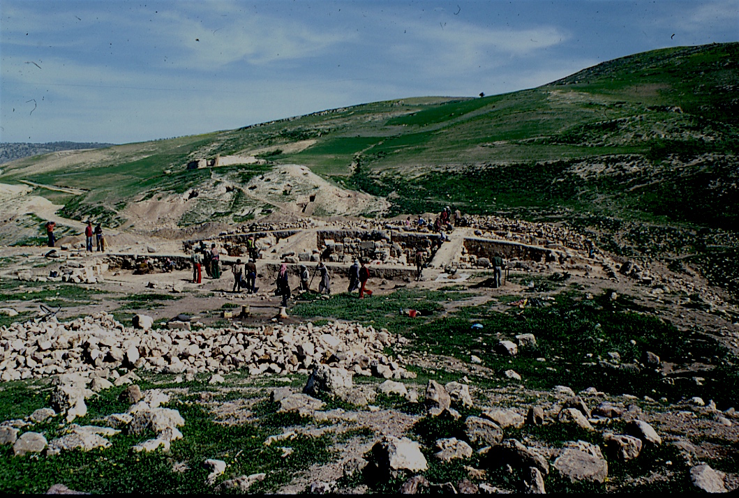
Area XXXII (Southern Tell) Iron Age II through Middle Bronze II (ca. 1700-800 BCE)
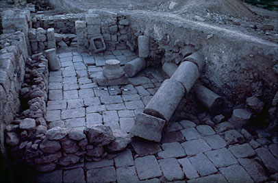
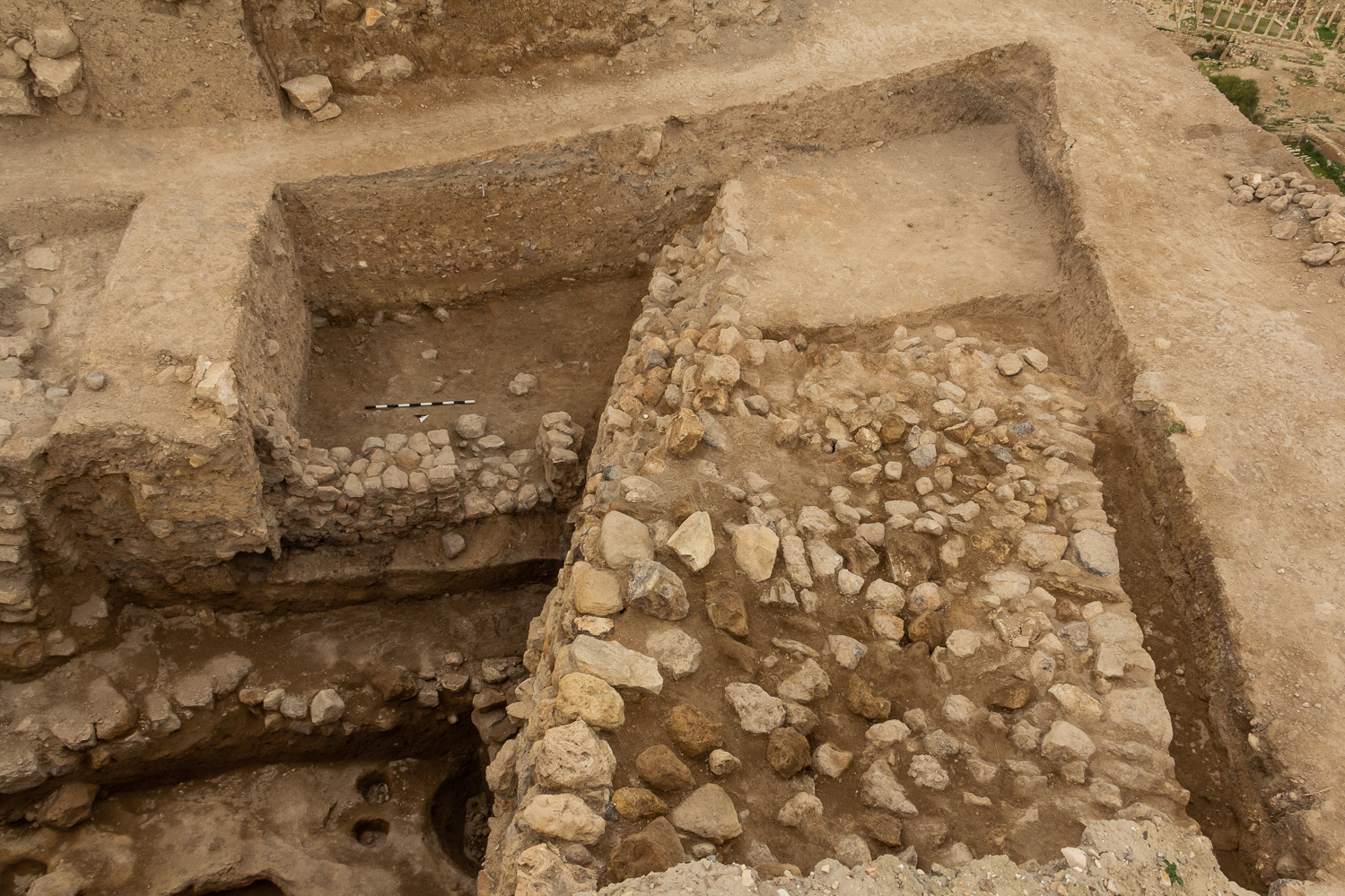
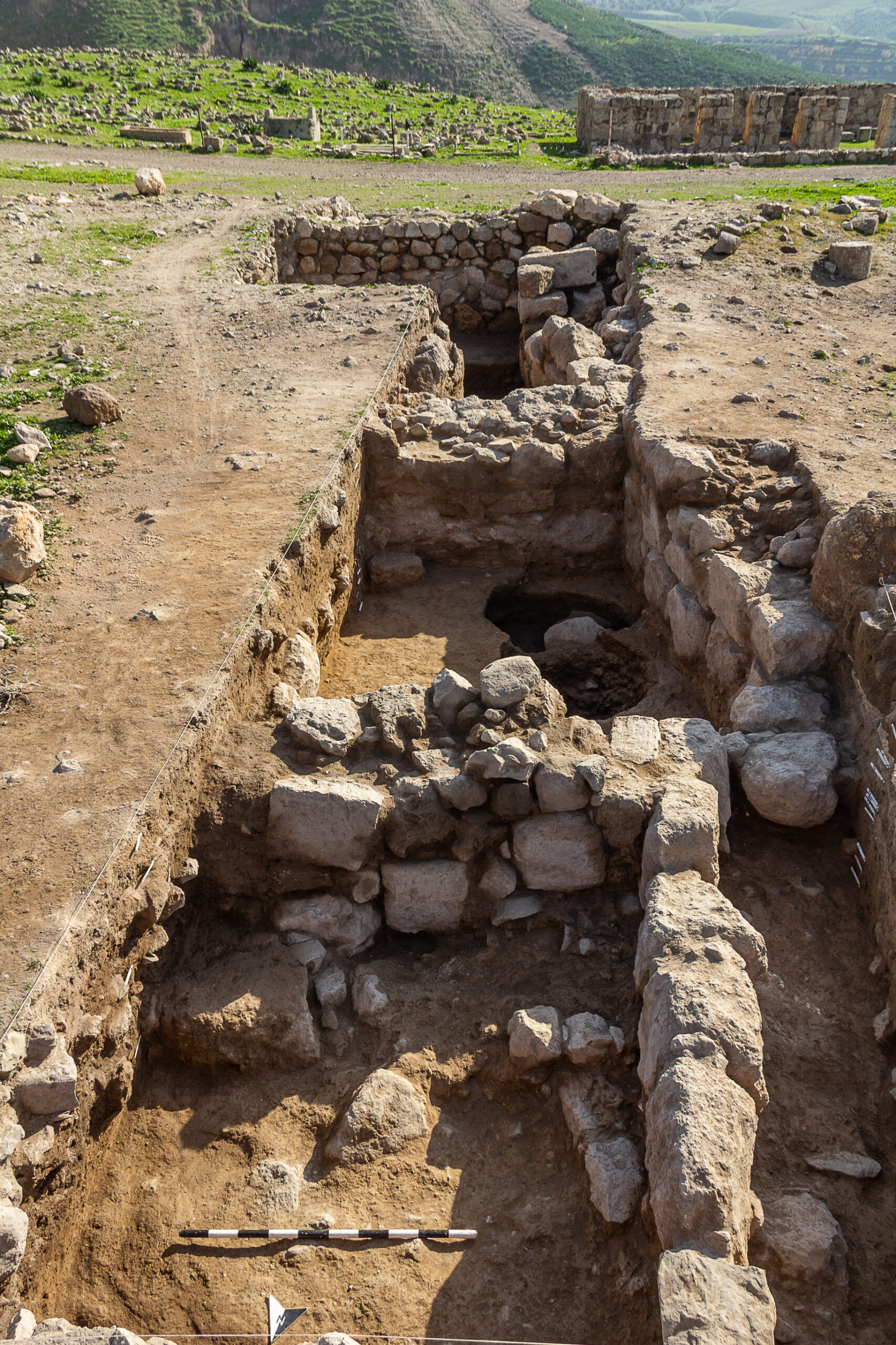
Area XXXII was instituted after 1986, when a very heavy rain-storm uncovered around 10m of the southern edge of the Early Bronze Age city wall. The first three trenches (XXXIIA-C) were opened in 1987 and considerably expanded over the years, as we began the exploration of the Neolithic through Early Bronze Age sequence on the southern edge of the mound. In the middle 1990s new trenches were added to the west (XXXIID-G), and these began to run up against a huge east/west stone wall, which quickly emerged as the southern wall of a monumental Middle Bronze Age (ca. 1700 BCE) Fortress temple, which proved to be very well preserved.
Over the course of the next ten seasons (1995-2011), a large excavation area spanning 40 x 30m was opened, and a series of six ‘stacked’ Bronze and Iron Age temples were explored, with the earliest dating early within the MB I (c. 1900 BCE) and the latest destroyed in the Iron Age II (c. 800 BCE). By the end of the 2011 season most of the necessary work had been completed on and beside the Temple, and work shifted to the large Iron Age II (ca. 900 BCE) Civic Building detected two metres to the west of the Temple.
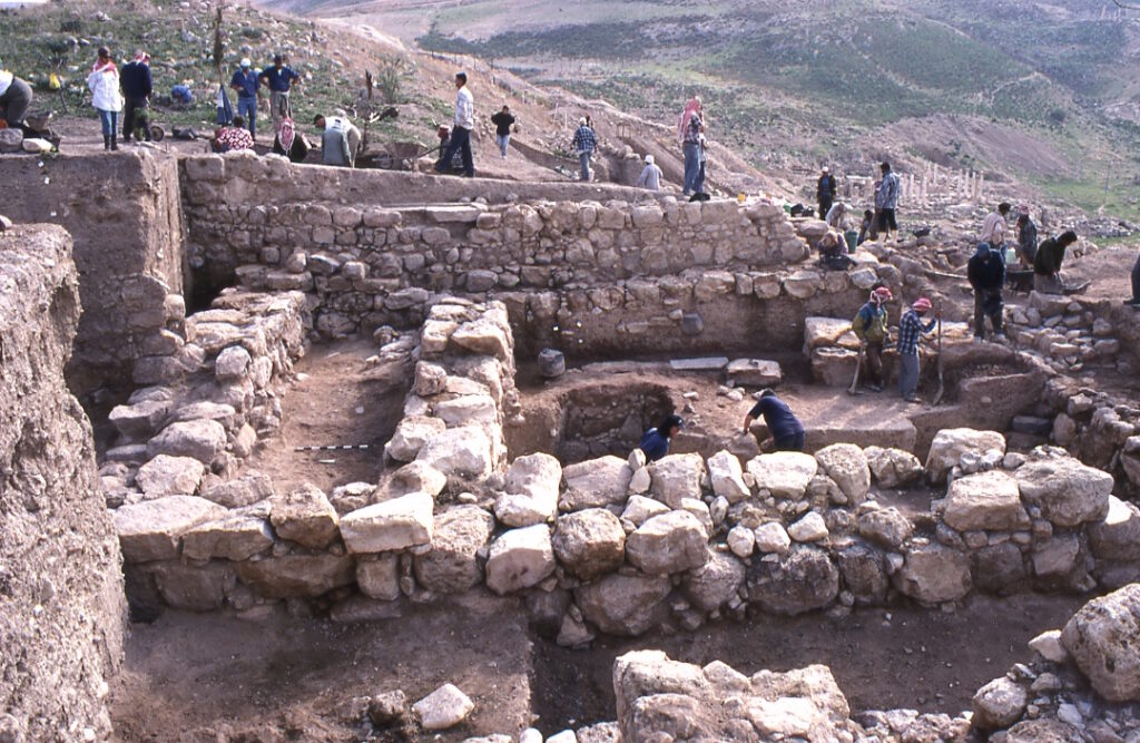

Work in the area west of the temple has been ongoing since 1997, but has expanded every year since 2005 to currently occupy an area of roughly 25 x 25m, with 3 x10m ‘offshoots’ to the north, west and south. Early work uncovered a very large Iron Age II Civic Building with more than 30 rooms, increasingly confidently identified as a local variant of the Bit-Hilani palace form, normally associated with north Syrian influences.
As work penetrated below Iron Age levels in more recent years, a series of Middle and Late Bronze Age Civic Buildings have emerged, ‘stacked’ similar to the temple series five metres to the east. The first encountered, a Late Bronze Age II (ca. 1400 BCE) structure, featuring stone-paved floors and pebble-paved courtyards. This sealed an earlier Late Bronze Age I (c. 1550 BCE) building of similar size, built upon almost identical lines.
In the most recent season of 2019, in two small rooms in the south-eastern edge of the LB I period building, an assemblage consisting of bronze figurines, faience, glass and semi-precious stone beads, an ivory hand-shaped object, pomegranate-shaped glass vessels, wooden and ivory small furniture pieces, a steatite female-figured spoon, along with a number of pottery and basalt vessels, were found below a thin destruction layer.
Work in this trench (XXXIIFF) is ongoing and will continue in the 2023 season. Clearance of the final three rooms of the LB I building currently available for excavation will be undertaken first, before the even larger Middle Bronze Age (ca. 1700 BCE) Courtyard Palace below it is further explored. This MBA structure was first detected in the southern reaches of the initial exposure in Trench XXXIIBB in 2013, with work steadily uncovering more and more of the potentially very large structure, as work north of Trench XXXIIBB penetrates into MBA layers.
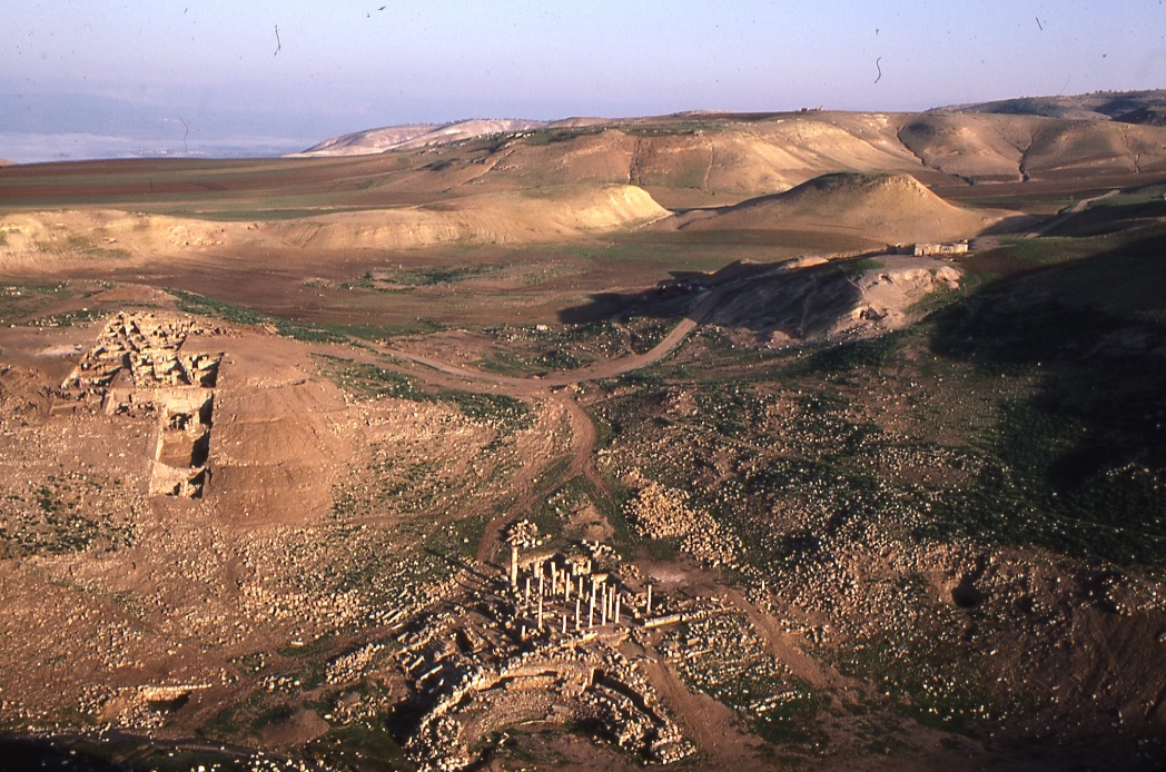
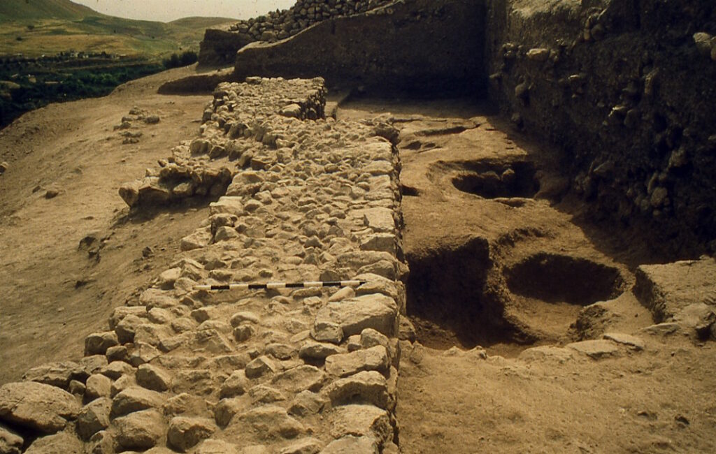
Area XXXIV (East Husn Summit) Chalcolithic through Middle Bronze III (ca. 4200-1600 BCE)
Excavations began on the Tell Husn Summit in 1988, initially to investigate the large Byzantine-period (ca. 400-600 CE) fortress known to exist on the summit. By 1993 excavations had uncovered all major structures of the fortress complex, and determined that the buildings rested upon a huge Early Bronze Age stone terrace system. As work on the main mound seeking to explore the Early Bronze Age had been largely stymied by the post-EBA monumental architecture that covered much of the earliest occupational strata, investigation into EBA horizons shifted to the Husn east summit in 1994.

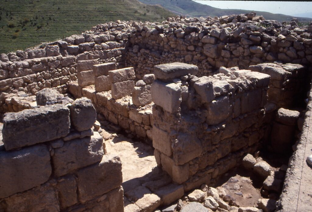
The first phase of EBA research on Husn, stretching over two long field seasons (1994-95) revealed a series of 15 x 15m stone terraces, each up to five metres thick, that lined the eastern edge of the summit, effectively levelling it up, and providing the base for monumental fortifications, stone-paved gateways, and narrow posterns, all designed to protect extensive storage facilities discovered within. All structures dated to the Early Bronze Age II (ca. 3000-2800 BCE) period, with the entire complex destroyed in a fiery collapse at the end of the EB II. Small probes in 1995 determined that a considerable sequence of earlier deposits lay below the terrace-complex, but discoveries on the main mound (the monumental Fortress temple) meant that work on Husn was paused, with resources re-directed to excavations on the main mound.
A second phase of work on the East Husn summit commenced in 2009, with the express purpose of investigating the earliest horizons of occupation below the terrace-complex. Six field seasons of renewed work (2009-2019) have revealed a six-phase sequence of pre-Classical occupation, stretching back into the Late Chalcolithic (ca. 4200 BCE), and including one phase of Early Bronze IA occupation (ca. 3700-3500 BCE), featuring apsidal architecture and a semi-circular round tower, two phases of Early Bronze Age IB occupation (3500-3000 BCE), including multi-room rectilinear architectural complexes and two phases of earlier direct-access gateways, all sealed below the stone-paved gate and terrace constructions of the EB II.
The EB II (3000-2800 BCE) terrace-complex, uncovered in 1994-95, sits on top of the EB IB sequence, with new work in the far northern reaches of the summit uncovering a 3.6m thick mud-brick circuit wall, running west from the northern terrace along the northern summit edge. On top of this more than thousand-year long sequence of walls and terraces, a small Middle Bronze Age (ca. 1700-1500 BCE) fortress rests against the inner face of the EBA circuit wall. A number of rich MBA burials, probably associated with this fortress, have been detected from time to time since 1994. One particularly rich ‘warrior burial’ was uncovered on the eastern slopes of the summit in 2019, complete with pottery offering vessels, and a bronze dagger and axe.
Work is ongoing on the Husn East Summit, with new work in 2023 planned to extend the sequence to the west along the northern edge of the hillside, where clear evidence of a devastating (late EB II) earthquake can be seen in the slumped sections of the 3.6m mud-brick circuit wall. This and associated destruction deposits will be targeted in 2023.